


My dad was not exactly a “back to nature” kind of guy.
His idea of outdoor recreation was sitting on the front porch, in his jockeys and white wife-beater T-shirt, smoking an unfiltered Camel, drinking a bottle of Coca Cola, and listening to the Baltimore Orioles play baseball on the radio.
So it wasn’t until I was in the fifth grade that I went on my first official hike.
My Sunday School teacher at Drexel First Baptist, a wonderful man whose last name was Clark, decided he would take our fifth grade class on a hike up Table Rock.
Wow!
I’ll never forget standing on the summit of Burke County’s most famous mountain on a crystal blue Saturday morning in April and being awestruck by the panorama before me. Towering mountains to the north, west, and south while the broad view of the Piedmont rolled off to the east.
Ten years old and I was hooked. A hiker for life. Or at least a hiker until my legs don’t work anymore.
Fast forward 15 years. I have recently moved back to Morganton after four years at Chapel Hill and three years of learning the journalism trade at a small weekly newspaper just outside metro Atlanta.
On another spectacular Saturday in the late April of 1980, I make my first visit to the recently established South Mountains State Park. I had counted myself lucky to be home. I thought myself to be even more blessed when I saw the tumbling waters of High Shoals Falls for the first time.
Spectacular!
In the 43 years since that first visit to SMSP, I have completed hundreds of hikes around Burke County, trekking thousands of miles, with brothers, with daughters, with faithful friends, and with even more faithful dogs.
So as the spring/summer outdoor season begins in earnest, I’d like to offer up, in no particular order, 10 of my favorite hiking trails contained within the borders of Burke.
Shortoff Mountain
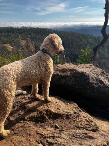
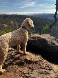
Shortoff Mountain, located on the east side of Linville Gorge, is a destination whose physical profile matches its name. It would be a short step off but a long way down to the Linville River far below.
Most folks prefer to access this hike by driving up the Wolf Pit Road, off Highway 126, to an often all-too-popular parking area.
I prefer to drive on past Wolf Pit, about half a mile, to a very small parking area on the right. Here begins the Connector Trail which goes north for a couple of miles before intersecting with the Mountains to the Sea Trail which leads to the top of the mountain.
The first mile and a half or so is a very gentle walk alongside the Linville River before the trail turns sharply up the mountain. If you just want a leisurely walk, perhaps with children, this is it, just go out and back.
But, if you want to attain the summit, be prepared to climb, and climb, and climb. But don’t worry. You’ll be rewarded with spectacular views of the Gorge, of Table Rock, of Grandfather, and of Mt. Mitchell at the top.
Length: Five miles each way. 10 miles out and back.
Hiking Time: For an old man who enjoys the view, most of the day.
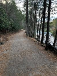
The Valdese Greenway
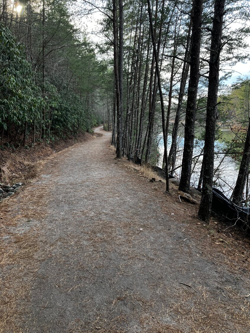
This greenway, which was officially completed just earlier this month, is an absolute jewel. It’s all crushed stone surface, which is very easy on the feet, and the huge mudpuddles which plagued it before the crushed stone surface was put down, are in the past now.
Parking is available at either end – near the picnic shelter at McGalliard Falls Park on the west side and at the Lakeside Park parking area on the east.
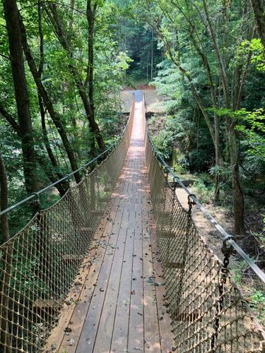
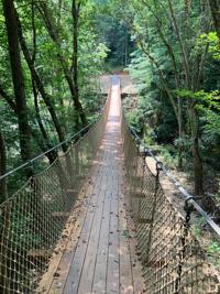
The path, coming from the west, parallels McGalliard Creek for about half a mile, before crossing said creek on a suspension bridge that is just high enough and has just enough swing to it to set the heart to racing a bit.
After crossing the creek, the path follows McGalliard Creek, widening as it nears Lake Rhodhiss before finally emptying into a beautiful, enclosed cove of that lake.
I completed this hike after supper on a recent April evening, and it was truly both a physical and a spiritual experience. The deep green of the newly-leafed trees, the late evening sun turning the lake to flame, a squawky heron fishing the cove.
Nice! Real nice!
Length: Two miles each way. Four miles out and back.
Hiking Time: Even stopping to enjoy the views, under two hours.
My Rating: An easy, rolling trek with fabulous scenery the entire route.
South Mountains – The Long Way Home
I’ll confess; it’s been several years since I made this 18-mile, mostly backcountry trek around the perimeter of the original boundary of South Mountains State Park.
I’ll also confess; it’s a real butt-kicker. An all-day, up and down, test of fortitude and endurance. Ain’t no flat ground in the South Mountains.
But, I’ll also confess. This is one of the most satisfying hikes I’ve ever made.
Park at the Cicero Branch parking area, on the left on the way into SMSP. Walk a short distance on the flat River Trail, until, just after crossing the Jacob Fork on a footbridge, you’ll come to the Raven Rock Trail on the left.
Turn left. And go up, and up, and up. Eventually, the trail becomes a paved road. Don’t worry. It’s the boundary between the park and the Pine Mountain community. Enjoy the spectacular views to the east and south, including, on a clear day, the Charlotte skyline.
Eventually the pavement ends and the trail returns to the woods. Soon after, turn right onto the Benn Knob Trail. Follow it to the Lower CC Trail. Follow it to the Horse Ridge Trail. Follow it to the Upper CC Trail. Follow it to the Little River Trail. And, follow the Little River Trail to the main trailhead parking.
From there, it’s half a mile on the River Trail back to the Cicero Branch parking area. If it’s warm weather and your feet are throbbing, swollen, and tired, take a few minutes to soak them in the chilling waters of the Jacob Fork River.
My, oh, my!
The thing I enjoy most about this long hike is the solitude. I have spotted turkey and deer on this hike. Seen where wild boars were rutting. Saw hawks and vultures circling above me. What I don’t see is people.
Length: An 18-mile loop.
Hiking Time: All day. Best during the Daylight Savings Time months of the year.
My Rating: If you’re fit, no better way to spend a day.
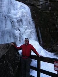
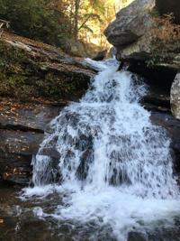
South Mountains – High Shoals Falls

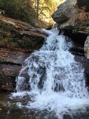
High Shoals Falls is the primary attraction – for most people – in South Mountains State Park. And it is indeed a beautiful, 60-foot waterfall, approached by a series of steps and boardwalks that offer plenty of views of the beautiful South Fork river.
The High Shoals Loop Trail, at 2.7 miles long, takes you to the falls, then continues on up, crossing the river above the falls, before descending on the other side.
But don’t be fooled by the modest length of the trail. It is strenuous and I wouldn’t approach it in anything less than sturdy hiking boots.
I also wouldn’t approach it during the summer months. It will be overrun with people, particularly if the day is warm and sunny.
Visit instead in the winter. You’ll have the trail to yourself if it is really cold, and you might even be granted the sight of the waterfall in a frozen state.
Pretty impressive.
Length: A 2.7-mile loop.
Hiking Time: Probably a little over an hour.
My Rating: Worth a visit if you’ve never been, but a trail to avoid in warm weather.
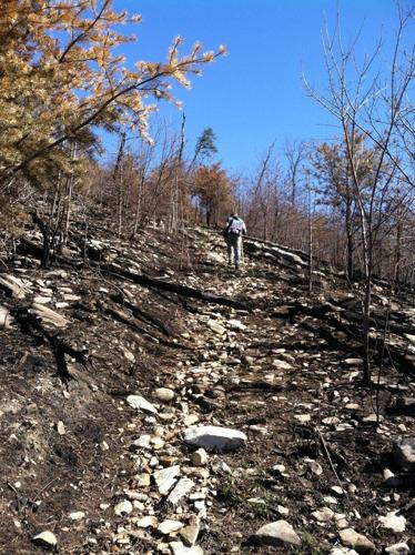
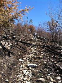
South Mountains – Chestnut Knob
I’ll never forget the first time I stood on Chestnut Knob and looked to the east. Early spring of 1990. The trail was not officially open yet, but a friendly park ranger had directed me there.
Easily the best view in the entire park. The Jacob Fork gorge. The Shinny Creek gorge. Benn Knob to the south. The Charlotte skyline, looking like the Emerald City of Oz, glistening in the afternoon sunlight to the east.
The climb is 2.6 miles up from the main trailhead parking lot, and is, of course, the same distance back down.
But, the woods are beautiful along the way, there’s an overlook of High Shoals Falls about halfway up, and the views at the top are superb.
Length: 5.2 miles, roundtrip.
Hiking Time: For an old man, four hours. Youngsters can divide by two.
My Rating: If I could only do one hike in South Mountain State Park, this would be it. Remember, it is a strenuous hike.
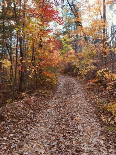
Fonta Flora Trail – Linville River to Lake James State Park
 More confession. I haven’t actually hiked this trail yet, at least not all of it, but only because the bridge which links the trail to Lake James State Park, near the newly opened visitor center, has only been open for a couple of months.
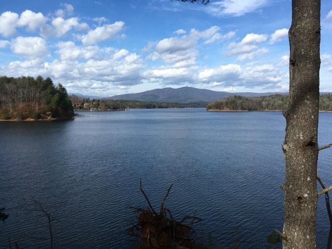
The parking area for his trail is on the west bank of the Linville River off Highway 126. Walking toward the south and west, the path crosses through some beautiful forests, before first offering views of North Carolina’s most beautiful lake at about the one-mile mark.
The trek wends along for another six miles, sometimes close to the lake, sometimes veering west from it, until it emerges on a cove of the lake to cross the newly constructed bridge and then climb the hill to the visitor center.
My plan is to do this trek with friends, first parking a car – and our lunches – at the visitor center, then driving over to the Linville River trailhead.
Length: Seven miles one way.
Hiking Time: Probably four to five hours, depending on how much time is spent bird-watching, view gazing, and resting.
My Rating: I’ve walked most of it before, so I know it’s going to be beautiful.
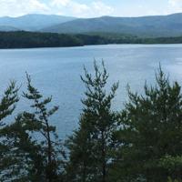
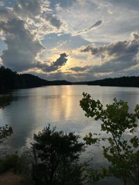
Mills Creek Trail – Lake James State Park
If you’re looking for a relatively short, relatively easy walk in the woods punctuated by gorgeous views of Lake James, this is your ticket to a pleasant afternoon.
If you’re standing at the restrooms at the park’s swimming beach, you can go left or right, depending upon which direction you want to head.
I prefer to do this 3.6-mile loop in the winter months when the leaves are off the trees and views of the lakes are basically unlimited. Spring brings lots of wildflowers and autumn provides stunning leaf color. Summer is likely to be hot, but there is a swimming beach nearby.
This is a great hike for kids, dogs, and older folks. Just take your time and enjoy the journey.
Length: 3.6-mile loop.
Hiking Time: Two to three hours. Or longer, if you’re in a reflective mood.
My Rating: Absolutely excellent hike. One that even my bride, who is not much of a hiker, loves.
Valdese Lakeside Park
Valdese Lakeside Park, which opened just three years ago but to which new trails and new amenities continue to be added, is a true jewel in Burke County’s crown of trails.
As noted elsewhere in this column, the Valdese Greenway has one terminus here, but the park also offers at least 10 miles of walking trails within its boundaries.
I say at least 10 because in addition to the marked and signed trails, the park is crisscrossed with old hunting trails developed when the land was owned by a hunting club, some easier to follow than others.
I like to make long loops here, made up of some combination of the Hoyle Creek, Outer Loop, Tributary, Rostan Creek, and High Line trails.
Although within the city limits of Valdese, this park is home to deer, turkey, beaver, mink and, at least twice, I have seen bald eagles there, up close and personal.
Length: Up to you. Check out the large trail map beside the restrooms, pick a route, and enjoy.
Hiking Time: Up to you. Some loops are as short as three miles, others as long as seven.
My Rating: I have fallen in love with this park and enjoy every visit.
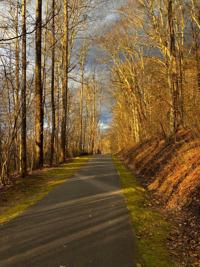
Morganton Greenway
 All right, all right. I hear some of you hard core types yelling that this is not a hike. It’s a paved stroll.
But park at the east end, just across the road from Grace Ridge at the Rocky Ford access, and walk west to Greenlee Ford, where Judge’s Barbecue used to stand. Then head around the soccer fields, tie back into the main greenway, and go east again.
By the time you get back to Rocky Ford, you will have walked roughly nine miles. And that, friends and neighbors, is a hike.
And what a hike it is. From Rocky Ford to Catawba Meadows, the trail has a remote feel to it, with the mighty Catawba on one side and woods and fields on the other.
From Catawba Meadows to the River Village Shopping Center, the trail passes the disc golf course and then goes under the Highway 181 bridge. From River Village to Greenlee Ford, the “original” section of the greenway crosses Silver Creek on an impressive bridge before ending at a wooded picnic area.
I call this my “urban hike,” and it’s especially enjoyable in the cooler months of the year.
Length: Roughly nine miles.
Hiking Time: Depends. If you stop to watch a softball game at Catawba Meadows, then have lunch and a brew at the Town Tavern, then enjoy a soccer match at the soccer complex, this could be an all-day walk.
My Rating: Excellent hike, even if it is on asphalt.
Lake View Trail — South Mountains State Park
The Clear Creek Access Area of South Mountains State Park, located off Highway 64 south of Morganton, has been open for more than a decade now. The state has big plans for the area, but so far those plans are nothing more than words and drawings on paper.
But, there are two hiking trails at this section of the state park. One, the Clear Creek Trail, is literally a walk to nowhere, but the other, the Lake View Trail, is a super-nice, short walk around the lake that was once the watershed for Broughton Hospital.
It's only a 1.3-mile circuit around the small lake, but you'll be treated to great views of the Blue Ridge Mountains and the body of water is home to a variety of birds, turtles, and beaver. My brother Johnny also reports seeing enormous water snakes while trekking here, but I've never been so blessed.
Speaking of my brother Johnny. He could lead you from this trail up a variety of old roads, rabbit paths, and bits of bush-whacking to the summit of the highest peak in South Mountains State Park, Buzzard Roost.
He could, but I can't, so I'll just tell you to enjoy the Lake View Trail instead.
Length: An easy 1.3 miles.
Hiking Time: Might as well slow down and enjoy. I'll say an hour.
My Rating: Excellent short hike. But keep an eye out for those water snakes.
Bill Poteat is editor of The Paper. He may be reached at 828-445-8596 or at bill@thepaper.media.


(0) comments
Welcome to the discussion.
Log In
Keep it Clean. Please avoid obscene, vulgar, lewd, racist or sexually-oriented language.
PLEASE TURN OFF YOUR CAPS LOCK.
Don't Threaten. Threats of harming another person will not be tolerated.
Be Truthful. Don't knowingly lie about anyone or anything.
Be Nice. No racism, sexism or any sort of -ism that is degrading to another person.
Be Proactive. Use the 'Report' link on each comment to let us know of abusive posts.
Share with Us. We'd love to hear eyewitness accounts, the history behind an article.