


Editor’s Note: Today, Editor Emeritus Bill Poteat takes a look at how South Mountains State Park is recovering from the ravages of Hurricane Helene. A similar story will examine Lake James State Park in our March 7 edition.
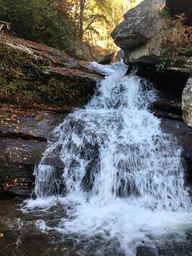
From the day it opened more than half a century ago, the most popular attraction at South Mountains State Park has been High Shoals Falls.
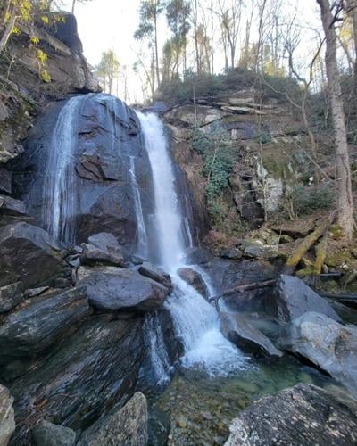
At the falls, the Jacob Fork River drops precipitously some 80 feet over a bare rock cliff to a crystal-clear pool at the bottom. Both above and below the main falls are a series of swirling cascades that make the falls even more visually spectacular.
Before the ravages of Hurricane Helene in late September of 2024, the loop trail up to the falls and then above and around it was easily the most-trafficked walking path in a park that has more than 40 miles of trails.
Hurricane Helene put an end to that, however. The storm dumped more than a foot of rain on the park and the resulting torrent of the Jacob Fork River swept away bridges, wrecked viewing platforms, and destroyed steps.
The trail was rendered unsafe and unusable and today, more than 17 months after Helene’s initial fury, it remains that way and no timetable has been established for its repair and reopening.
“The High Shoals Falls Loop Trail is still closed,” said Park Superintendent Lance Huss. “And currently there is not a timetable for reopening the trail.”
Huss went on to explain that a regional trail specialist has visited the trail several times in the past few months, making assessments and taking measurements of the trail’s destroyed and damaged infrastructure.
Only when that assessment is completed, Huss said, can a comprehensive plan for repair and redevelopment of the popular trail be completed.
In addition to the High Shoals Falls Loop Trail, three other popular hiking trails in the park remain closed, Huss said: Headquarters Trail, Possum Trail, and Shinny Trail.
Huss explained that one bridge on Headquarters Trail was badly damaged while another was totally destroyed. Both Possum and Shinny intersect with Headquarters, making their closure necessary.
The park was able to recently reopen its equestrian day use area and campground, meaning that most of the trails where horse riding is permitted around the perimeter of the park, including Saddleback, Horse Ridge, and Little River, are open for horse traffic again.
Not surprisingly, closing of the entire park from Sept. 27, 2024, until April 9, 2025, and the indefinite closure of the High Shoals Loop Trail have dramatically impacted visitation to the park.
During Fiscal Year 2023-24, 431,494 people visited the park, which is about a half-hour drive to the south of Morganton. In Fiscal Year 2024-25, that number plummeted to 210,009.
Huss noted that all of South Mountains’ camping areas are now open, as is its visitors center, picnic areas, and most of its trail system.
“There’s still an awful lot to see, experience, and enjoy in this park,” said Huss. “We look forward to seeing a lot more visitors at the park as the weather begins to warm up in the coming weeks and months.”
As to long-term improvements at South Mountains, Huss said restoration of the High Shoals Loop will be the top priority, but that work is also expected to begin this year on an upgrade to the Clear Creek Access section of the park.
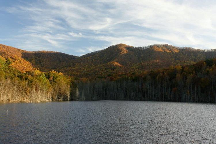
Clear Creek is about 10 miles south of Morganton off U.S. 64 and is highlighted by the old Broughton Hospital Reservoir, now known as Clear Creek Lake, which is available for fishing and paddling.
Clear Creek features two hiking trails, one of which circles the lake (keep an eye out for beaver and a variety of snakes) and another which simply meanders through the forests before ending at the 2-mile mark.
Huss said the state plans to improve the access to Clear Creek, build a bigger parking area, and construct a vaulted toilet facility.
Clear Creek will remain a “day use” only part of the park with no visitors center and no overnight camping allowed.
Although Creek Creek Access Area and the Jacob Fork Access Area are contiguous to each other, no plans exist to build a hiking trail linking the two sections.
The reason? The tallest and steepest range in the South Mountains lies between the two areas, highlighted by the towering summit of Buzzard Roost which, at a little more than 3,000 feet in elevation, is the highest peak in the park.


(0) comments
Welcome to the discussion.
Log In
Keep it Clean. Please avoid obscene, vulgar, lewd, racist or sexually-oriented language.
PLEASE TURN OFF YOUR CAPS LOCK.
Don't Threaten. Threats of harming another person will not be tolerated.
Be Truthful. Don't knowingly lie about anyone or anything.
Be Nice. No racism, sexism or any sort of -ism that is degrading to another person.
Be Proactive. Use the 'Report' link on each comment to let us know of abusive posts.
Share with Us. We'd love to hear eyewitness accounts, the history behind an article.